GPS-RTK North Finder
With Tilt Measurement
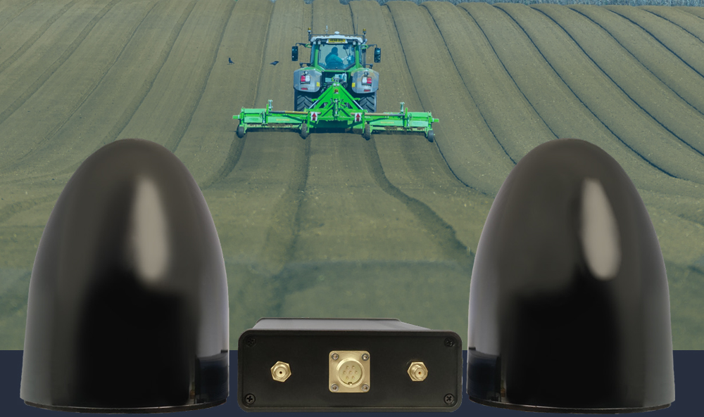
GPS-RTK North Finder is a satellite system used to accurately determine geographical location and orientation. This product is a precision tool that uses GPS satellite technology along with radio communications with a base station to determine the direction of the North.
GPS-RTK stands for GPS Real-time Kinematic, where a base station in a fixed location monitors atmospheric and tidal changes, then transmits instant information to devices for calculating their position with centimeter accuracy.
The North Finder GPS-RTK can accurately determine the north direction without requiring manual calibration, making it suitable for applications such as mapping, construction, mining, and the oil and gas industry.


Key Features
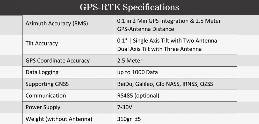
- Support for multiple GNSS standards such as GLONASS, BeiDou, Galileo, and...
- The ability to receive data from diverse satellites and combine them optimally
- Measurement of slope and location
- Increasing accuracy by extending the length of the antenna arms
- Capability for data storage
Technical Specifications

Some Applications
- Highly precise mapping
- Accurate positioning measurement
- Tracking of agricultural machinery
- Precise location in mining
- Accurate orientation in the oil and gas industry


بدون دیدگاه